
Trace a Hamilton Street by Address
A Hamilton street search is an address trail, not a roster. Start with the Butler County Auditor in Hamilton, which links an address to the current parcel record. That record supplies the parcel identification number, situs address, legal-description text, owner display, and transfer clues. Those details form a better bridge to later records than a street name alone. The Butler County Recorder in Hamilton can then connect the parcel's legal description or named parties to recorded documents. Historic Hamilton directories and maps can add an earlier occupant or physical context, but neither replaces the deed trail.
Use the same order for each Hamilton property or several nearby parcels. It keeps each fact in its proper lane. A public owner line may be useful for a Hamilton deed search. A listed address may help locate a directory entry. Neither statement proves the full present household.
- Run the street number and name in the Butler County Auditor Address Search for Hamilton. Omit the street suffix, then try a street-only or wildcard search if the first attempt fails.
- Save the PIN, situs address, owner display, legal description, and transfer clue from the Hamilton parcel card. Keep the current data date in view when comparing a recent change.
- Confirm the parcel in the Butler County Auditor GIS for Hamilton and use its road and parcel context. The map helps place land, not identify a household.
- Search the Butler County Recorder in Hamilton with the buyer or seller, document date, and legal-description clues. Match the legal description and document number or book/page, not merely a common name.
- For an earlier era, use the geographical index and then a Hamilton city or criss-cross directory. These sources can place an address in time, while gaps and publication lag remain possible.
Start Hamilton Streets With a Parcel
The Butler County Auditor Property Search serves Hamilton streets through distinct owner, address, parcel, advanced, map, and sales modes. For a Hamilton street directory task, address mode is the practical start. Enter the number and street name without a suffix. A street-only search can return matching Hamilton addresses, which is useful when the exact number is unknown. Parcel mode accepts all or part of a parcel number. Most parcel numbers are 14 characters, manufactured-home records are usually 8, and RID or TIF records may be 15.
The Butler County Auditor address-search screen for Hamilton shows the route used to begin a street query.
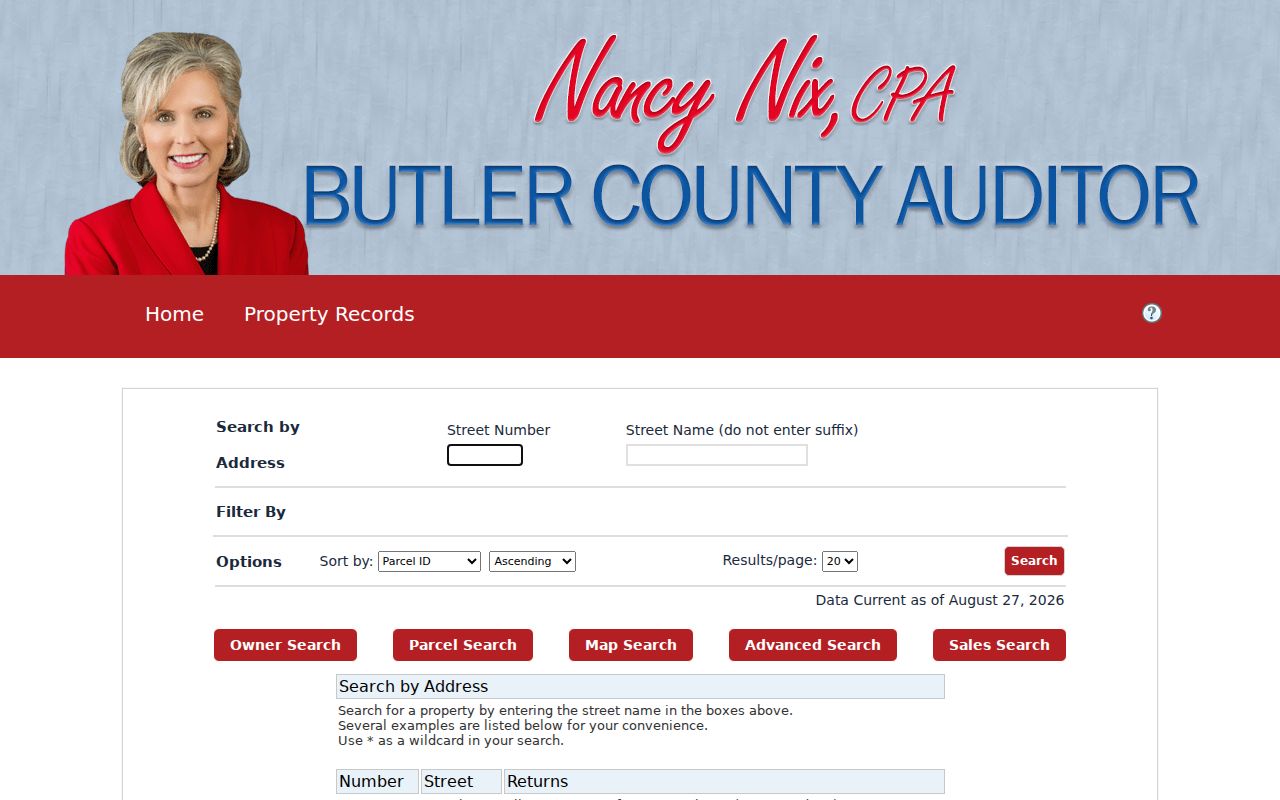
Use the Hamilton result as a parcel lead, then read the complete card before drawing a conclusion from any single name or address field.
| Auditor field or route | Input | Hamilton search use |
|---|---|---|
| Address Search | Street number and street name | Do not enter a suffix; a street-only query can return matching Hamilton addresses. |
| Owners | LastName FirstName | No comma; full or partial names for a Hamilton owner work, and * is a wildcard. |
| Parcel Search | All or part of a parcel ID | Most parcel IDs in Hamilton have 14 characters; the portal accepts partial numbers and wildcards. |
| Advanced or Sales | Selected criteria and date range | At least one criterion is required; filters in Hamilton's portal change with the selected mode. |
| Map Search | Map route | Use it to place a Hamilton parcel after the address or PIN is known. |
Read Hamilton Parcel Fields Carefully
A Hamilton parcel card can show the PIN, situs address, class, land-use or neighborhood and taxing district, acreage, structure details, values, taxes, credits or exemptions, owner lines, legal description, transfers, and sale amount. It also has separate tax-bill mailing-name and mailing-address fields. That separation matters. Hamilton's Butler County GIS data likewise distinguishes the property LOCATION from MAILNAM and MAILADR fields.
The Butler County Auditor's sample parcel profile for a Hamilton address shows the kind of detail opened after an address or PIN search.
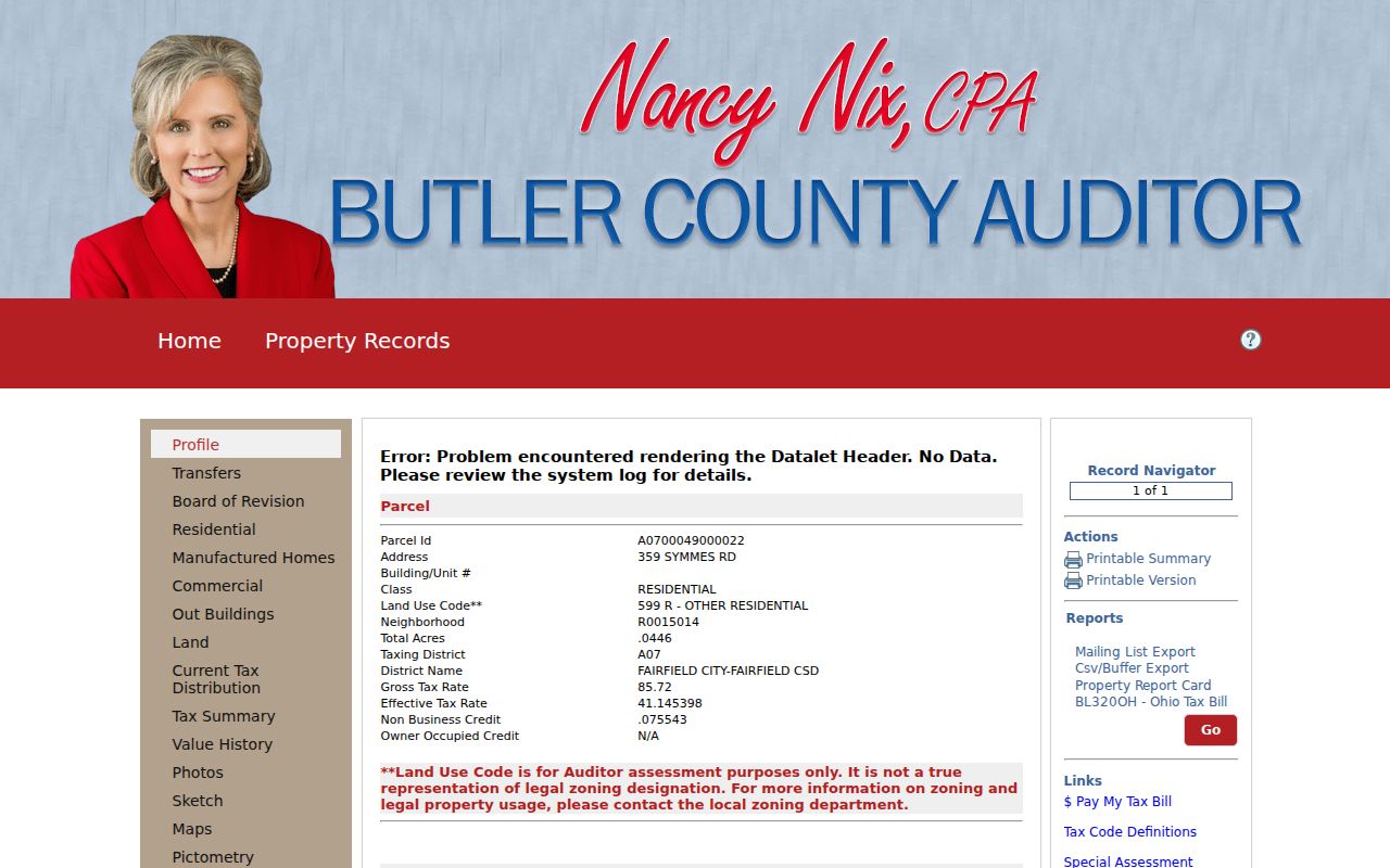
Read the profile for the Hamilton parcel as a collection of separate property fields. The transfer, legal-description, and map tabs can lead to the next record, while the mailing line should remain a tax-correspondence field.
A mailing address for a Hamilton parcel is a correspondence destination. It can belong to an owner, estate, company, or agent away from the parcel. The street directory should therefore treat a mailing field as a way to understand a tax record, not as evidence of who occupies an address. The same caution applies when the property card presents a transfer or value.
- Parcel or PIN
- Butler County's identifier for one Hamilton property record. It ties the address search to maps, transfers, and tax information.
- Situs address
- The physical location of a Hamilton parcel. It differs from a tax-bill mailing address.
- Legal description
- The lot, block, subdivision, or other land description for a Hamilton parcel used in recorded property documents. It is stronger than a street label for older research.
- Plat
- A recorded map of a Hamilton subdivision that can show lots, blocks, and layout. It supplies land context, not a list of occupants.
Note: Preserve the exact PIN and legal wording before moving between the Auditor, GIS, and Recorder systems serving Hamilton, because the street name alone can change over time.
Hamilton Street Directory Mailing-Field Myth
A tax-bill mailing line can make a Hamilton street directory result look more personal than it is. The Butler County Auditor in Hamilton records the property LOCATION separately from MAILNAM and MAILADR fields. The Hamilton parcel card also separates owner lines, the situs address, transfers, and tax-bill mailing information. Those labels describe different parts of a property record. An off-site correspondence line can belong to an owner, estate, company, or agent. It is not a finding about who is present at the street address.
Keep the wording from each field with the record it came from. A current owner display for a Hamilton parcel can supply a Recorder search term. The situs address of a Hamilton parcel can identify the mapped parcel. A legal description for a Hamilton parcel can keep a deed search tied to the correct lot or subdivision. None of those fields supplies a complete household list. This distinction matters especially when a recent transfer leads from a current Hamilton parcel card to a recorded document.
Use Hamilton GIS Near Me
The current Hamilton Butler County Auditor GIS Viewer combines roads, current parcels, municipalities, townships, flood-hazard areas, and aerial imagery. Its Near Me view produces a Current Parcels (Proximity) result. The documented fields include PIN, LOCATION, MAILNAM1 and MAILNAM2, MAILADR1 through MAILADR3, and approximate distance. This gives a careful way to see nearby Hamilton mapped parcels after an anchor address has been verified.
The Hamilton Auditor GIS map search provides the mapped route used beside a Hamilton street directory query.
Record the nearby Hamilton PIN, location, and distance, then return each PIN to the Hamilton property search and Recorder when a parcel-history question remains. Near Me is a physical-parcel tool, not a social-neighbor list.
Follow Hamilton Street Deed Clues
The Hamilton Recorder's current real-estate materials identify 1987 to present as indexed and imaged. For earlier Hamilton documents, book and page remain the route to an image after an index bridge is found. The Hamilton Recorder's notice says its imaging project is complete, yet an expected image can still need office follow-up. That is different from assuming a missing search result means no document exists. The Hamilton Recorder can also help at 130 High Street, second floor, by email at recorder@bcohio.gov, or by mail request with advance payment and a postage-paid envelope.
Use the current Hamilton grantor or grantee, date, document type, document number, book/page, and legal description as a connected set of clues. A deed's grantor can become an earlier grantee search when tracing backward, provided the lot, subdivision, legal description, or book/page continuity still matches. The Hamilton Recorder does not perform a title search, so a complete title opinion is outside this street-directory process.
The Hamilton Recorder geographical-index page is the pre-1987 bridge for city, township, village, subdivision, and condominium searches.
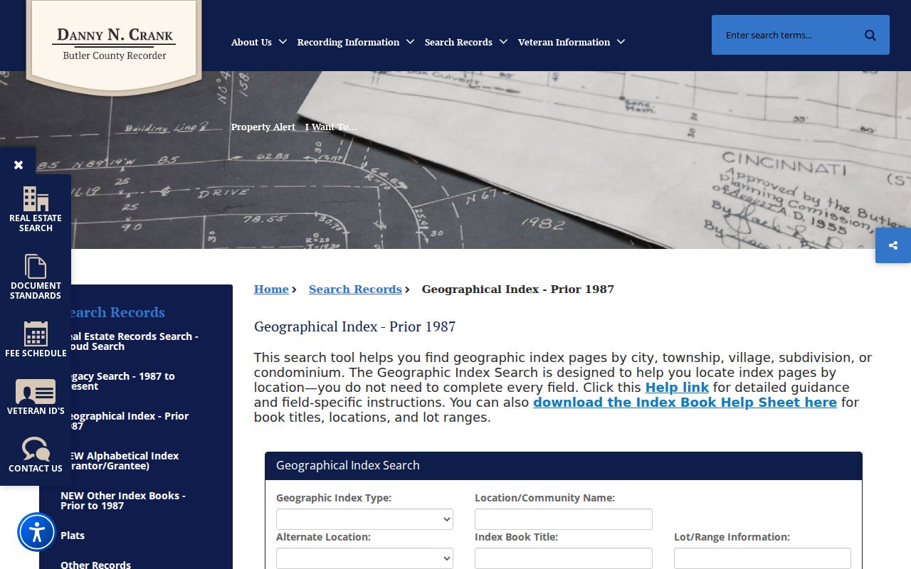
The geographical index can lead to a book and page or a historic Hamilton location reference, after which the underlying record should be checked for the legal description and named parties.
Check Hamilton Street Name Bridges
Old and current Hamilton road names can both be necessary. The City of Hamilton Street Index says the in-city portion of Hamilton-Cleves Road became Pyramid Hill Boulevard, and Hamilton-Richmond Road is now Main Street. The digitized 1912 Hamilton City Guide also notes that Alston changed to Charles. Search both terms when an older directory, deed, or map uses a name that does not appear in a present address query.
Other continuity clues need case-specific reading. The City of Hamilton list marks Joe Nuxhall Way as formerly Forest Lake Lane without an effective date. Hamilton Planning minutes document an April 1997 annexation in the Stahlheber Road and northwest Washington Boulevard area, with a zoning and property-line mismatch. Recorder annexations and City Planning or Clerk records are better sources when municipal status or a vacated street is the issue.
Hamilton Street Records by Address
Different Hamilton address records serve different functions. The table separates the Hamilton public parcel and instrument trail from historical context. It also shows why a street directory should not collapse an owner, a mailing destination, a recorded party, and an occupant into the same claim.
| Hamilton address record | Hamilton keeper | Hamilton result | Hamilton limit |
|---|---|---|---|
| Hamilton parcel and tax record | Butler County Auditor | Owner display, situs, PIN, legal text, values, sales, tax district, and mapped parcel. | Owner and mailing fields do not prove current occupancy. |
| Hamilton GIS parcel view | Butler County Auditor GIS | Parcel geometry, nearby parcels, roads, districts, flood context, and imagery. | A map is not a legal survey or household list. |
| Hamilton deed or related instrument | Butler County Recorder | Parties, record date, document number, book/page, and legal description. | A named party is not automatically a resident. |
| Hamilton historical geographical index or atlas | Butler County Recorder | Subdivision, lot, location, boundary, and book/page bridges. | Coverage varies and an index bridge may be needed. |
| Hamilton directory or address-history item | Lane Library and related collections | Earlier listed occupant, address, street context, or vacant notation. | Publication gaps and lag make absence inconclusive. |
| Hamilton permit or historic-district item | City of Hamilton | Named applicant or owner, date, and work at an address. | Activity at a property is not proof of occupancy. |
For an older household question, the historical directory collections are treated in depth on the Hamilton city directory page. Use the current parcel and deed trail first when the goal is to establish the property connection.
Use Hamilton Address Permit Records
City of Hamilton building, ADRB, and permit materials can add a date and a named applicant or owner to an address history. Hamilton's Cityworks permits and licensing channel is not represented as an exhaustive historic permit search. When a specific record is needed, identify the address, approximate period, and record type. A City of Hamilton public-records request can seek existing records, but the City does not have to create a new record or conduct research. Hamilton accepts an oral or written request, and the Records Commission provides the policy, form, and department retention schedules.
The City contractor-registration resource illustrates one building-related channel.
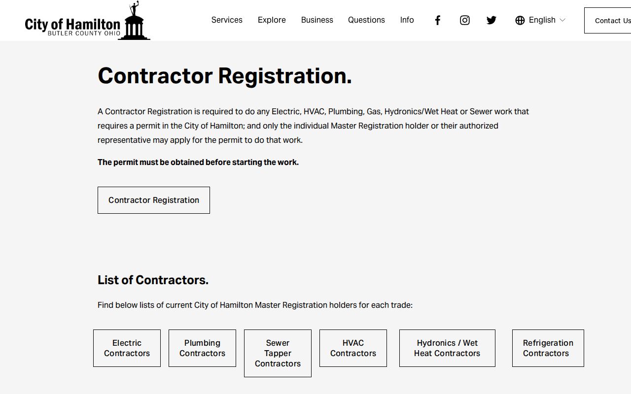
The form includes trade, company or mailing information, authorized signers, and trade-proof material. It should not be read as an address-occupancy record or a complete directory.
Verify Hamilton Street Ranges
A street name by itself can cross more than one delivery area. Hamilton's Street Index gives a street name, side or parity, low and high number, and ZIP. That is more precise for an address than a regional postal polygon. For example, Belle Avenue has an odd 1003 to 1099 range in 45015 and an even 1008 to 1038 range in 45011. South Erie Boulevard and Tylersville Road also have documented number-range splits.
Get the exact number, verify delivery with USPS, then compare the municipal street range or GIS when a jurisdiction question matters. Postal ZIPs do not define city limits. The Recorder also does not organize its legal record chain by a universal ZIP code, so return to the Auditor address and parcel fields for the first search.
Note: A matching street name or ZIP narrows the search, but the number range and parcel record are the better Hamilton street-directory confirmation.
Limits of a Hamilton Street Directory
Hamilton's address-keyed sources can establish public property and record connections. They cannot identify every person at an address. The Auditor distinguishes situs from mailing fields, GIS Near Me is limited to parcel geography, and a Recorder instrument identifies legal parties rather than a household. Historic directories can show a listed person or vacant notation for a published year, but gaps and abbreviations matter.
Some records are also confidential or restricted. Ohio's voter materials have protected fields, and the City does not publish a comprehensive neighborhood membership or resident-contact roster. Do not turn a parcel map, tax mailing field, or older directory into a street-wide list of people.
Lawful use. Use Hamilton address records for personal, lawful property or family-history research, and never use public information to stalk, harass, or harm another person.